
Aerial Mapping
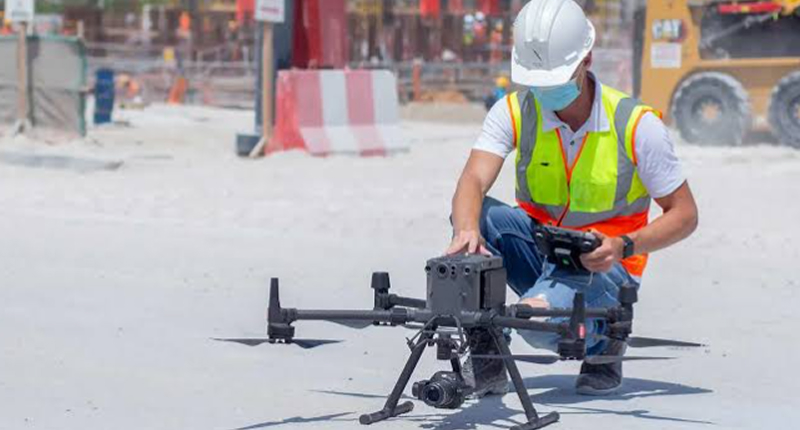
Walking a large site with a GNSS rover takes days. A drone can cover it in hours. We fly mapping missions with ground control on site, then turn the images into accurate maps, surface models and volume reports.
- Ground control for real accuracy
- Orthomosaics, DSM and contours
- Flights planned around UAE airspace rules
Aerial mapping services

Drone photogrammetry
The drone flies a planned grid and captures overlapping images. Using ground control points surveyed on site, we process those images into a measurable 3D model of the area. It works well for open land, roads, quarries and construction sites.
- Planned flight lines with high overlap
- Ground control points surveyed on site
- Accuracy report with every project
Orthomosaic maps
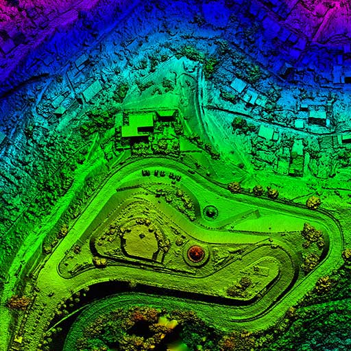
An orthomosaic is a single, corrected aerial image where every pixel sits in its true position. You can measure distances and areas directly from it, and it gives everyone on the project a clear, current picture of the site.
- High resolution, georeferenced imagery
- Usable in CAD and GIS
- Great for progress records
Surface models and contours
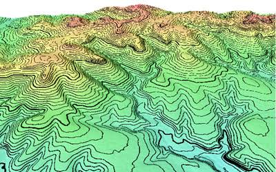
From the same flight we produce a digital surface model and, where the ground is clear, contours and spot levels. For large or rough sites this is often the fastest way to get a full topographic picture.
- Digital surface and terrain models
- Contours at your chosen interval
- Combined with ground survey where needed

Stockpile and earthwork volumes
We measure stockpiles, borrow pits and cut and fill areas from the air, quickly and without stopping work. Repeat flights let you track volumes month by month.
- Volumes for stockpiles and pits
- Repeat surveys for monthly tracking
- Clear volume report with images
Who uses aerial mapping?
Developers
Fast site overviews for planning and marketing.
Contractors
Progress records and earthwork volumes.
Planners
Up to date base maps for large areas.
Quarries and industry
Regular stockpile and pit measurements.
How a drone survey is delivered
- 1
Site and airspace check
We review the location, airspace and any permissions needed.
- 2
Flight planning
Flight lines, height and overlap are set for the accuracy you need.
- 3
Ground control
Control points are surveyed on site before or during the flight.
- 4
Flight and processing
Images are captured, then processed into maps and models.
- 5
Delivery
You receive the outputs with an accuracy summary.
Common questions
Do drones need a permit in the UAE?
Yes. Commercial drone flights in the UAE need a registered aircraft and approval for the flight, and some areas are restricted or closed. We check the location and handle the approvals before we schedule the flight.
How accurate is a drone survey?
With good ground control, results are typically within a few centimeters, depending on flight height and ground conditions. Every project comes with a short accuracy report so you can see the actual figures.
Can a drone replace a ground survey?
For open areas and volumes, often yes. Where you need detail under trees, inside buildings or around services, we combine the drone data with a ground survey.
What happens if the weather is bad?
Strong wind and dust affect image quality and flight safety. If conditions are poor on the day, we move the flight to the next suitable slot and keep you updated.
Talk to our team
- Tel+971 4 352 3678
- Mobile+971 58 582 2220
- Emailinfo@precise.ae